PicStork Super 30 Challenge
Title: Aerial Floorscape Precision with DroneNaksha
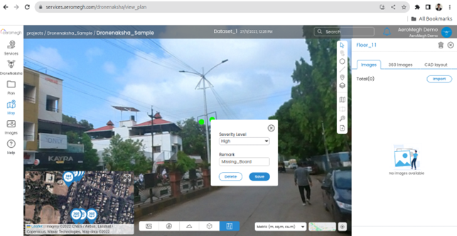
DroneNaksha is a flexible and effective tool that changes the way users plan, and annotate 360-degree photographs with remarkable precision in the ever-evolving world of floor planning and aerial imagery. This special feature allows you to annotate objects in depth with notes and severity ratings, in addition to providing a detailed view of the floors. Let’s explore how 360-degree photos are used by DroneNaksha to make floorwise annotations a smooth and effective procedure.
Advantages of Floorwise Annotations in DroneNaksha:
- Accurate Planning: By providing users with realistic 360-degree views, users can precisely comprehend floor plans, which facilitates effective planning and resource allocation.
- Detailed Analysis: Remarks and severity levels, along with object annotations, allow for a detailed examination of floor components, which aids in problem identification and maintenance schedule development.
- Improved Collaboration: Team members can work together more effectively because of the version control and cloud-based storage features, which make sure that everyone is working with the most recent and accurate data.