PicStork Super 30 Challenge
Title: Farm Guardian: Making Sure Farmers Know Their Land
In India, many people are farmers. They work on their land, growing food. But sometimes, they’re not sure who owns which part of the land. This can create big problems! Thankfully, there’s a solution that helps solve these problems by showing clear information, making it easier for people to make decisions about their land.
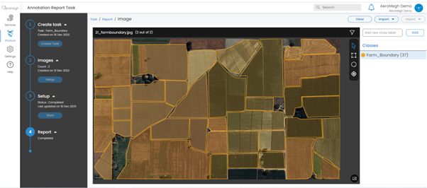
What does this solution do? It creates clear maps that mark where a farmer’s land starts and finishes. This might seem like a small thing, but for farmers, it’s really important. Firstly, these maps help farmers know for sure which part of the land is theirs. No more arguments or fights about who owns what. This makes farmers happy because they’re sure about their land.
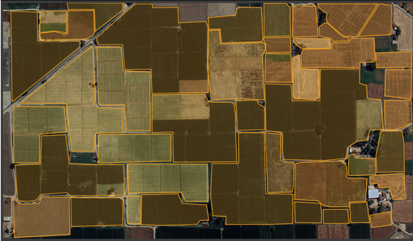
Secondly, having these clear maps helps farmers plan better. When they know how big their fields are, they can choose which crops to grow where, how to use water and resources wisely, and how to take care of their farms better. But this solution doesn’t only assist farmers. It also compares these maps with what the government has recorded. This is good because it allows farmers to receive assistance from the government since this solution ensures that the information about their land is accurate.
Secondly, having these clear maps helps farmers plan better. When they know how big their fields are, they can choose which crops to grow where, how to use water and resources wisely, and how to take care of their farms better. But this solution doesn’t only assist farmers. It also compares these maps with what the government has recorded. This is good because it allows farmers to receive assistance from the government since this solution ensures that the information about their land is accurate.